
Balkan Skyline Trail
( Sammiana section Z2 : Vratnica – Rostuse bridge – 202.3km )
There are trails that connect mountains. And then there is the Balkan Skyline Trail – a long distance trail that refuses to come down.
Z2 is the second section of the West Wing of the Sammiana – Macedonian Endless Trail, designed with one singular purpose: to stay as high as possible for as long as possible. With an average elevation of 2,030 meters sustained over 202 kilometers, this is the highest long-distance hiking trail in the Balkans and among the most elevated long distance routes in Europe.
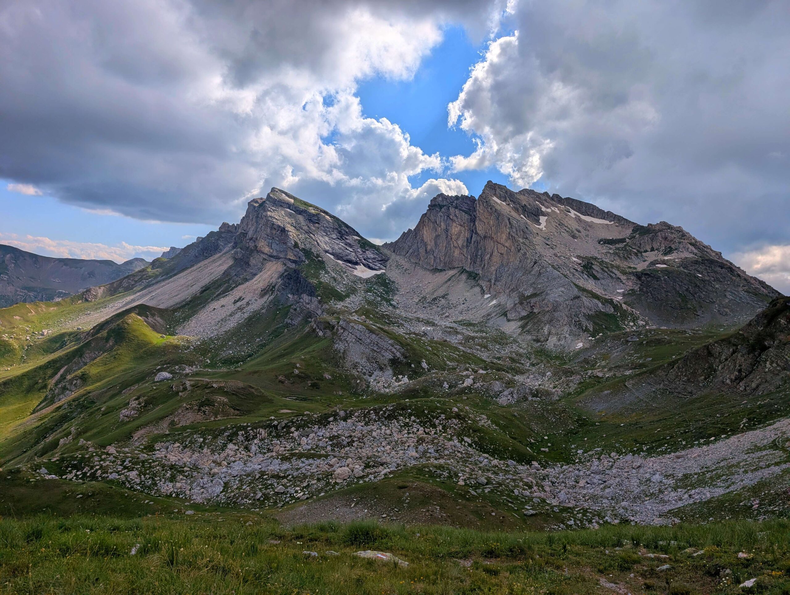
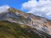
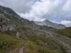
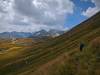
The trail follows the ridge of Shar Mountains and the Korab Massif – two Macedonian giants that remain virtually unknown in the international hiking community. Shar Mountains is a mountain world unto itself: alpine pastures above 2,000 meters, glacial lakes scattered across stone basins, ridges that don’t descend but continue – one after another – toward the horizon. Korab, at 2,764 meters, dominates the western section with raw, uncompromising presence.
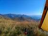
This is not a trail for hikers seeking infrastructure. There are no mountain huts or guest houses every day, no roads nearby, markings are currently sparse, and help if needed is far away. But what does exist is authentic mountain wilderness – uninhabited, unprotected, uncrowded, and above all, stunningly beautiful in ways Europe can increasingly seldom offer. Navigation depends on GPS, water comes primarily from mountain springs and streams, and weather changes at this altitude arrive fast and without warning. Are you prepared for this challenge?
Trail Closures and Updates ( Last updated: July 2026 ):
- The trail has been rerouted between Z2-7630R and Z2-7680D. The new route is clearly waymarked on the ground.
Trail Overview
| Total Distance | 202.3 km |
| Estimated Hiking Time | 7-10 days |
| Difficulty | Very Strenuous |
| Highest Point | Peak Golem Korab , 2764m ( short detour from the trail ) |
| Average Elevation | 2,030 m ( 65% of the trail is above 2000m ) |
| Trail Marking | Partly marked (GPS mandatory) |
| Best Season | July to October (snow-free high passes) |
| Trail type | Mountain goat paths, occasional dirt roads, zero asphalt |
| Backpacking type | Wild camping throughout. Popova Sapka tourist center (Segment 3) offers hotels and restaurants. Several guesthouses in villages down in the valleys. |
| Water Availability | Very Good. With purification methods excellent |
WARNING: The Korab segment traverses expert-level alpine terrain. Not recommended for hikers without prior experience on technical high-altitude routes. Several segments include exposure, require careful navigation, and are dangerous in poor weather. Very dangerous or impassable in snow conditions.
Section Highlights
- Ljuboten Peak (2,498 m) – iconic Shar summit
- Dobroste Lakes – glacial lakes beneath Ezerski Peak
- Peskovi Ridge – exposed alpine traverse along the main Shar mountains ridge
- Kobilica-Treskavec-Vrtop trio – three monumental peaks defining the Shar skyline
- Karanikola Lake – possibly the most beautiful glacial lake on Shar mountain
- Lesnica Valley – dramatic gorge surrounded by towering rock walls
- Crno Ezero (Black Lake) – remote glacial lake in high alpine cirque
- Golem Korab (2,764 m) – highest peak in Macedonia and Albania
- Ziberova Kula – spectacular viewpoint over the entire Korab Massif
- Korab ridge traverse – technical alpine route through vertical landscapes
- Desat and Krcin ranges – continuation of the high ridge system
- Radika Valley descent – transition from alpine wilderness to pastoral landscapes

Elevation profile:
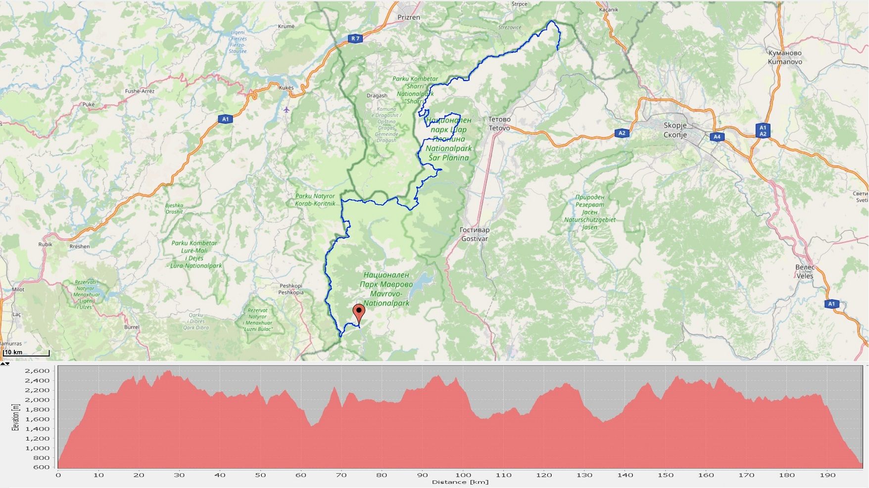
Google Map :
Gallery




Essential Planning Information
Best Time to Visit
July through September is the optimal window when high passes are reliably snow-free. June can work in low-snow years but you may face snowfields that make navigation dangerous. October may bring early winter storms. This is not a shoulder-season trail.
Water Sources
Water availability is generally excellent, with mountain springs, streams, and glacial lakes providing reliable sources. The longest waterless section is approximately 8 km between Piribreg and Dobroste Lakes when following the ridgeline. Always carry 2 liters capacity and purification capability. Late season (August-September) may see reduced flow in streams.
Accommodation & Resupply
This is a wild camping traverse. The only infrastructure is Popova Sapka tourist center (Segment 3), offering hotels, restaurants, and road access to the town of Tetovo. Villages at start (Vratnica) and end (Rostuse) have resupply options. Plan to carry 3-5 days of food for the Korab sections. Ljuboten Hut and Villa Ljuboten are the only mountain huts directly on route – no others exist. Descent into valley villages remains an option for accommodation and resupply throughout.
High Scardus Trail
The Balkan Skyline Trail intersects – and on some stretches overlaps – with the High Scardus Trail (HST), another long-distance route through the region. The key difference: HST is designed as a Hut to Hut trail, with each stage ending in a valley village where guesthouses are available. This makes HST stages a useful fallback if you need accommodation or need to exit the route. Note that you’ll need a border permit if you want to descend from Balkan Skyline route ( North Macedonia only) into Kosovo or Albania. For more information, visit the High Scardus Trail website.
Navigation
GPS and basic orientation skill is mandatory. Trail marking is still minimal to non-existent throughout most sections. Download complete GPS tracks and offline maps before departure. Carry backup battery/power bank. In poor visibility (fog, storms), navigation becomes difficult even with GPS.
National Parks
This section passes through Mavrovo National Park and Shar Mountain National Park. Respect all park regulations and visit the websites for latest info.
Note:
Mavrovo NP: Daily entry permit required (purchase online )
Shar Mountain NP: Vehicle access fees apply
Campfires strictly prohibited within park boundaries!
Livestock Guardian Dogs
When moving through high pastures on this section you may encounter flocks of sheep accompanied by livestock guardian dogs that react protectively toward the flock with barking and aggressive behavior, which they are trained to do. Avoid passing in immediate proximity to sheep flocks, and if dogs react, respond calmly and make contact with the shepherd who will safely guide you past the flock. Best to make contact with the shepherd before approaching the flock.
Wildlife
Brown bears and wolves are present throughout the Shar Mountains and Korab Massif – encounters are rare but possible, particularly in forested sections at lower elevations. Make noise while hiking and store food properly. Chamois are frequently visible on rocky terrain, especially on the Korab sections. Golden eagles and other raptors are a common sight above the ridgeline
Weather & Safety
Mountain weather at 2,000+ meters changes rapidly. Afternoon thunderstorms are common in summer. Temperatures can drop below freezing at night even in August. The Korab sections (Segment 5) include genuine alpine exposure-falls could be fatal. Do not underestimate this route. Rescue from remote sections can take 12-24 hours even in good conditions. Emergency number: 112 (general). Cell signal is generally good close to ridges but weak or non-existent in valleys and canyons.
GPS track:
The GPS track for section Z2 ( Balkan Skyline Trail) contains all waypoints, markers and digital elevation data
Download the complete GPS track ( English version 22.05.2026) :
KML format for this section HERE
GPX format for this section HERE
For explanations of marker meanings, trail types, and coding used in the GPS files, consult the technical information page HERE
Detailed Segment Descriptions ( 6 segments )
Segment 1: Vratnica – Dobroste Lakes
Distance: ~23 km | Difficulty: Strenuous
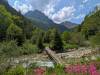
The Balkan Skyline Trail begins at the edge of Vratnica village, where the route immediately separates you from civilization and leads into the embrace of old beech forest. The first kilometers feature gentle but persistent ascent along a beautiful forest trail, where tree canopies create deep shade even on the hottest summer days. As you gain elevation, the forest becomes increasingly picturesque -beech, oak, evergreens, with numerous streams and springs that keep the environment fresh and pleasant. The path climbs steadily but without dramatic steepness at first, allowing time to settle into rhythm and enjoy the sounds of forest and water.
With further ascent you leave the forest behind, pass the Ljuboten Hut and after that the scree slopes below Ljuboten Peak, one of Shar Mountain’s most distinctive summits, before suddenly emerging at the saddle below Ljuboten. Here a new experience begins , where you traverse with much gentler gradient in proximity to the ridgeline all the way to Kucinagledski Peak (also known as Piribeg). On this segment you’ll feel the need to check your map and verify your GPS signal. From the summit itself, the trail continues west with slightly more pronounced elevation changes but still on soft trail that gradually becomes more technical as you approach Ezerski Peak. Before the main ridge of Ezerski Peak, the trail descends to the slopes below the peak, specifically to the upper Dobroste Lake.
Trail Status: The trail to the saddle below Ljuboten is largely marked, but afterward you’ll need to monitor GPS signal periodically. Water is plentiful along the route, except in the section between Piribeg and Dobroste Lakes when the trail follows or stays near the main Shar ridge.
Segment 2: Dobroste Lakes – Karanikola Lake
Distance: ~24km | Difficulty: Very Strenuous
From the upper Dobroste Lake you briefly ascend to the southern ridge below Ezerski Peak. Here the trail becomes less technical and requires more frequent GPS checking, until emerging onto the main Shar ridge, where you continue along an interesting but demanding trail all the way to Peskovi Peak. From there the trail becomes softer again, passing through expansive meadows with mountain grass and wide views toward the entire Polog Valley, as well as the entire northern side of the Kosovo portion of Shar Mountain, due to the fact that you’re often moving directly along the mountain’s spine. As you continue along the traverse you gradually approach from the north side the Kobilica-Treskavec-Vrtop trio -some of the most recognized and distinctive peaks of the Shar massif, where you’ll feel their magnitude. The trail then leads from their gentler southern side, so you’ll experience the full beauty of these peaks. After passing Vrtop, the trail becomes more benign and, after crossing several fast mountain streams and rivers, leads to the shore of perhaps the most beautiful lake on Shar mountain – Karanikola Lake.
Trail Status: In this segment the trail is highly varied -from slightly technical and rocky, through well-trodden and clear trail, to open wide meadows where you’ll need to orient according to GPS signal and map. Water is available in several places; however, you’ll still need to plan because in the first half of this segment you’re moving along the ridgeline. Due to this fact, also consider your exposure to weather conditions.
Segment 3: Karanikola Lake – Popova Sapka
Distance: ~31km | Difficulty: Strenuous
This segment begins at the famous Karanikola Lake, from where after a brief ascent you gain one of the most scenic views of the Lesnica Valley and the rocky peaks that surround it-an environment you’ll traverse for almost the entire segment, feeling Lesnica’s beauty in every detail. The trail first descends into the Skakalecka River gorge, then climbs again onto the slopes below Skakala and Zalina peaks, crossing an open boulder field to the small glacial lake Sorupa. After a brief climb beyond Sorupa, the trail begins descending more rapidly into the heart of Lesnica and after a long time re-enters the evergreen forest belt that surrounds this renowned valley. Well-known Lesnica locations follow – the Krivosija pools and Krivosija waterfall, where the trail steeply ascends the other side of Lesnica, specifically the southern side of the “three Lesnica rocks”, as these enormous peaks hanging over Lesnica Valley are called. After passing the col below Plat Peak (the first Lesnica rock), the trail soon emerges onto a mountain dirt road that leads all the way to the Popova Sapka tourist and ski center, which is very close to the actual trail route.
Trail Status: The trail is marked only in the first few kilometers, after which follows a somewhat longer section where you’ll need to check GPS signal more frequently until descending into Lesnica and occasionally beyond toward Popova Sapka. Water is abundant in this segment.
Segment 4: Popova Sapka – Lukovo Pole
Distance: ~58km | Difficulty: Strenuous
From Popova Sapka, the first 6 kilometers follow a wide mountain road with minimal elevation change. After departing the road, a section follows through expansive mountain meadows where the trail is often unclear but movement is easy, and the route leads with slightly greater gradient back to the main Shar ridge. Upon reaching the ridge itself, on the border with Kosovo – you simultaneously approach Borioslavec from the south side – yet another distinctive Shar peak/ridge, while en route passing at the foot of Celepinski Peak. The trail then crosses to the southern side of Borislavec, descending to the beautiful Crno Ezero (Black Lake) – another of the beautiful Shar glacial lakes nestled in a scenic high-altitude environment. Descending from Crno Ezero brings you to a dirt mountain road that leads without major elevation changes into one of the most remote and wild parts of Shar Mountain – the Mazdraca River valley, above which rise the twin peaks Mala and Golema Vraca, and through which you’ll briefly pass through a beautiful forested section of the valley. Ascent follows southward toward Budimov Grob, from where the environment changes again to gentler meadows where you emerge onto a mountain tracks that leads west all the way to Dolno Lukovo Pole, en route passing below Radika Peak, the last significant peak of the Shar massif.
Trail Status: The trail in this segment is almost completely unmarked. At the beginning and end of this segment you move along wide mountain roads, but in the central part you’ll need to periodically check the gps and the map. The longest section without water source is 8 km.
Segment 5: Lukovo Pole – Skrtec Pass
Distance: ~36 km | Difficulty: EXTREME (Technical alpine route)
WARNING: This segment is technical and dangerous on some stretches. Not recommended for hikers without alpine experience. Exposure, scrambling, and potential for serious injury or death in poor conditions. Do not attempt with residual snow or in bad weather.
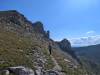
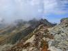
This section of the trail leads through one of the most powerful, most beautiful, but also most severe regions of Macedonia – the Korab Massif. From Lukovo Pole you set out through wide-open space, with a feeling that the mountain hasn’t yet decided whether to let you in or not. Soon you reach the ridgeline of the northernmost part of the Korab massif, where the trail turns south and follows the ridge toward Ziberova Kula peak, which undoubtedly has one of the most beautiful views on the entire traverse, where you’ll feel the power of what lies before you—the high rocky peaks of the Korab massif. A brief descent follows to the Golema Korabska Vrata pass, and the name itself says this is the great gate to Korab, from where you continue through vertical contrasts in immediate proximity to the Korab peaks Bel Kamen, Crna Cuka, and Kepi Bard, to join the main trail between Strezimir and Golem Korab and soon leave it again in the direction of Mal Korab and Dlaboka River valley. You continue along alpine, predominantly narrow, and in places even dangerous trail. Every step on this section offers a different angle of the mountain, revealing hidden cirques and ravines that appear untouched by humans. After passing Izgrevo Lake and several more distinctive Korab peaks, suddenly a wider high-altitude space opens again with expansive meadows—the Skrtec Pass.
Trail Status: In good conditions this is spectacular. In poor conditions—full concentration required in places, while passage is completely not recommended while snow remains or in significantly poor weather conditions. A small portion of the trail is marked and on much of the trail the route is clear, but nevertheless in several places you’ll need to check GPS signal. Water is available sufficiently but planning is needed considering the slower movement and difficulty of terrain. This segment is not recommended for hikers who have not previously had experience moving on such terrain.
Segment 6: Skrtec Pass – Rostuse Bridge
Distance: ~30km | Difficulty: Moderate to Strenuous
From Skrtec Pass you continue along the Korab massif on much more benign and well-trodden trail along which you’ll also cross the Desat and Krcin mountains, a trail that leads continuously southward all the way to the foot of Golem Krcin Peak. Although more benign, nevertheless on this part of the west side the high rocky peaks still dominate, which will unashamedly fill your views and won’t let you relax and forget where you are. However, here new vistas also open toward the deep valleys and opposing ridges of Bistra Mountain. After passing Velivar and Golem Krcin peaks, the trail leaves the ridge and begins gradual descent toward Radika Valley. The change is fast and palpable—the open alpine space closes, deep forest returns, you transition from the severe world of high ridges toward the gentle valleys of the Reka region. Civilization appears and you pass near several Reka villages—Bituse, Velebrdo, and Rostuse, and soon after you finish at the Radika River bridge where the Balkan Skyline Trail ends, specifically Section Z2 of the Macedonian Endless Trail.
Trail Status: The trail in this segment is predominantly wider and well-trodden, and in certain sections also marked. Nevertheless in some places you’ll need to orient according to GPS signal because the trail intersects with several other trails. Water springs and fountains are in several places along the trail and this won’t present a problem.
Experience the Journey
The Sammiana section Z2 , or Balkan Skyline Trail is not for everyone, and it knows this. It makes no apologies for its demands. This is a route that asks much -physical endurance, technical competence, navigation skill, self-reliance, and a willingness to be genuinely alone in the mountains for days at a time.
What it offers in return is something increasingly rare in Europe: authentic alpine wilderness experience. Ridges that stretch to the horizon. Glacial lakes untouched by tourism infrastructure. Peaks that see perhaps a dozen hikers per season. The silence of high places. The satisfaction of crossing terrain through your own competence rather than the support of established infrastructure.
Shar Mountains and Korab remain Macedonia’s secret giants -mountain ranges of extraordinary beauty that are somehow still largely unknown to the international hiking community The Balkan Skyline Trail offers the chance to experience them as few others have: not from valley roads or tourist viewpoints, but from along their spines, moving as the mountains themselves move – high, continuous, uncompromising.
If you have the skills, the experience, and the desire for genuine mountain wilderness, the Balkan Skyline Trail awaits.
Is This Trail Right for You?
The section Z2 is not a tourist product. It’s a trail built for the mountains, not for the masses. It was not engineered for comfort, it was not designed for high visitor numbers, and the mountain itself is the only infrastructure you will find. And mountains are beautiful, but that beauty can become a danger when storm hits.
If you just started building your long-distance hiking experience, or if you prefer trails with detailed signposting, mountain huts, and established support along the route – there are many alternatives that will suit you better right now. The other sections of the Sammiana trail offer equally stunning mountain terrain , with more accessible logistics and a wide range of difficulty levels.
The Balkan Skyline Trail will still be here when you are ready for it. And when you are – it will exceed everything you expected.
Enjoy hiking – Leave only footprints – Take only photographs